---

Weather Underground PWS KSDPIERR15

Corp Missouri River Dam Engineering Summary

Fairway Drive Photo Album1 2011

Fairway Drive Photo Album2 2011

Lampy's Pierre SD River Watch Page

NOAA Hydrograph Hwy 14-34 Bridge Pierre SD

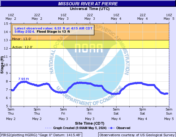
NOAA Hydrograph Lake Oahe Pool Level Pierre SD

Some Other Links

Montana Snow Pack

Corp Moisture Compare

Corp Missouri Basin Information

NOAA River Gauge graphic Hwy 14-34 Bridge

NOAA Lake Oahe Pool Level

USGS River Gauge Hwy 14-34 Bridge USGS & Corp

USGS Bad River Gauge Ft Pierre

USGS River Gauge LaFrambois Island

NWS Precipitation Map

NWS Adv Hydro Prediction

Corp Reservoir Forecast

Corp Reservoir Daily report

Corp OAHE production orders

Bismark River Flow

Sioux City River Flow

Omaha River Flow

Kansas City River Flow

AccuWeather Radar

US Color Enhanced Satellite